Author Description
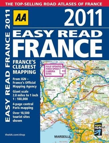
TRAVEL / ROAD MAPS & ATLASES. Fully revised and updated for 2011, this specialist, easy-to-read A4 road atlas designed for the British motorist in France includes 86 city centre plans, plus new Paris city plans, to help you find your way around busy centres. Static speed camera locations are pinpointed on the mapping and French names are used to match local road signs. A route planner detailing major routes, ferries and airports is included and there is a distance and journey times chart between 50 destinations. Coverage includes Corsica and the atlas legend is in English, French, Spanish, Italian, German and Dutch.
Page Count:
418
Publication Date:
2010-01-01
ISBN-10:
0749567481
ISBN-13:
9780749567484
Community Tags
Reader Comments
Share Your Thoughts
No comments yet. Be the first to share your thoughts!