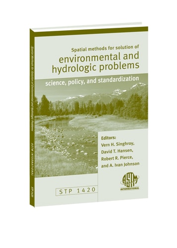
Spatial Methods for Solution of Environmental and Hydrologic Problems: Science, Policy, and Standardization STP1420
0
0
As an Amazon Associate and affiliate partner, Menrva Books earns from qualifying purchases. Learn more
Author Description
Get an international perspective on the latest issues relating to spatial analysis, accuracy in the location and special representation of data and real world features, and emerging standards for digital spatial methods and applications. Twelve peer-reviewed papers cover: Accuracy and Uncertainty in Spatial Data and Analysis -Application of krieging and other geostatistical techniques -Fractal analysis for spatial applications -Difficulty in defining the level of accuracy for environmental and hydrologic data -Spatial variability, uncertainty, and risk for use in decision support systems -Use and application of global positioning systems (GPS) Modeling and Spatial Analysis of Environmental and Hydrologic Systems in Spatial Data Environments -Spatial techniques to model environmental systems -Development of object models for hydrologic systems. -Development of a flood warning system for watersheds in Spain -Modeling the distribution of soil moisture with remote sensing and geographic information systems (GIS) -Data integration with GIS as a management tool for decision support -Efforts to model surface soil moisture from satellite microwave observations -Use of response units to assess erosion processes in semiarid areas in southern Africa Standardization and Standard Digital Data Sets -Methods, descriptions, and digital data products, such as the watershed boundary standards for the U.S. -Status of standards in use by the U.S. government related to GIS data -Role of other organizations in the development of standards for GIS -Development of standard merged products of satellite imagery and elevation data for natural resource mapping in Canada -Development of a series of standard digital databases, in which U.S. Geological Survey has been particularly active This publication is based on a symposium sponsored by AST
Menrva's Summary
THE THESIS
This collection addresses the critical need for standardized spatial methods in environmental and hydrologic problem-solving. The book compiles twelve peer-reviewed papers from an international symposium, focusing on accuracy, uncertainty, and emerging standards in digital spatial data and applications. It explores geostatistical techniques, fractal analysis, and the challenges of defining accuracy for environmental data, alongside modeling approaches for environmental and hydrologic systems using tools like GPS, GIS, and remote sensing. Furthermore, it details efforts in standardization, including watershed boundary standards and the development of standard digital databases and merged products for natural resource mapping.
THE SCOPE MAP
- Accuracy and Uncertainty in Spatial Data and Analysis, including geostatistical techniques and fractal analysis.
- Modeling and Spatial Analysis of Environmental and Hydrologic Systems, covering environmental system modeling, object models for hydrologic systems, flood warning systems, and soil moisture modeling.
- Application of global positioning systems (GPS) and geographic information systems (GIS) in environmental and hydrologic studies.
- Data integration with GIS as a management tool for decision support.
- Standardization efforts for digital spatial data, including watershed boundary standards and U.S. government GIS data standards.
- Development of standard merged products of satellite imagery and elevation data for natural resource mapping.
- Creation of standard digital databases, with a focus on U.S. Geological Survey activities.
THE AUTHORITY PERSPECTIVE
This publication, based on a symposium sponsored by ASTM, presents a collection of peer-reviewed papers offering an international perspective on spatial methods in environmental and hydrologic science. The content is structured around key themes of accuracy and uncertainty in spatial data, modeling of environmental and hydrologic systems, and the crucial area of standardization for digital spatial data and applications. The papers cover a range of specific applications and methodologies, reflecting a collaborative effort to advance the field through scientific rigor and the establishment of common standards.
Page Count:
167
Publication Date:
2003-12-01
Publisher:
ASTM International
ISBN-10:
0803154739
ISBN-13:
9780803154735
Science
Non-Fiction
Hydrology
Spatial analysis
Community Tags
Similar Books








Reader Comments
Share Your Thoughts
No comments yet. Be the first to share your thoughts!