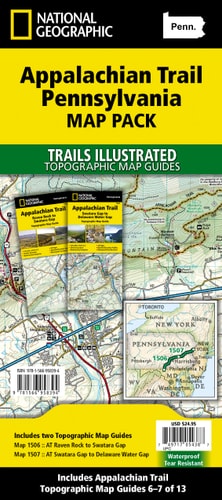
National Geographic Trails Illustrated Map 2020 Appalachian Trail Pennsylvania Map Pack Bundle
0
0
As an Amazon Associate and affiliate partner, Menrva Books earns from qualifying purchases. Learn more
Author Description
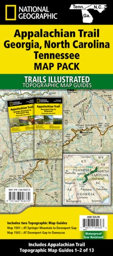
- Waterproof - Tear-Resistant - Topographic Maps The Appalachian Trail (AT) Map Pack Bundle of Pennsylvania includes two Topographic Map Guides that cover the entire AT in the Keystone State. The map follows the ridges of the Appalachian Mountains and weaves in and out of suburbia. This section of trail, which is notoriously rocky, is rich in history with traces of early industry--charcoal furnaces, railroads, and coal mining. Each AT Topographic Map Guide includes detailed topographic maps at a detail of 1 inch = 1 mile. Each page is centered on the A.T. and overlaps with the adjacent pages so there is little chance of getting lost. Along the bottom of each page is a trail profile that shows the distance between shelters, camping areas, and trail access points. The map and trail profile provide a step by step visual guide to hiking the trail, mile by rugged mile. The Topographic Map Guide is built for all levels of hiking enthusiasts, from the day tripper to the multi month 'thru-hiker'. The front pages of the printed Topographic Map Guide include resupply information, town inset maps, camping options, and much more. Buy the Map Pack and save over 15%! The Appalachian Trail: Pennsylvania [Map Pack Bundle] includes: Map 1506:: Raven Rock to Swatara Gap [Pennsylvania] Map 1507:: Swatara Gap to Delaware Water Gap [Pennsylvania] More convenient and easier to use than folded maps, but just as compact and lightweight, National Geographic's Topographic Map Guide booklets are printed on 'Backcountry Tough' waterproof, tear-resistant paper with stainless steel staples. A full UTM grid is printed on the map to aid with GPS navigation. Map Scale = 1:63,360 Folded Size = 4.25 x 9.38
Menrva's Summary
THE THESIS
The Appalachian Trail in Pennsylvania is detailed in this two-map bundle, highlighting its rugged terrain and historical significance. This map pack covers the entire AT in the Keystone State, following the Appalachian Mountains and navigating through suburban areas. The trail is known for its rocky sections and traces of early industry, including charcoal furnaces, railroads, and coal mining operations. Each map provides detailed topographic information at a scale of 1 inch to 1 mile, with overlapping pages for continuous coverage and trail profiles showing distances to shelters, camping areas, and access points.
THE SCOPE MAP
- Detailed topographic maps of the Appalachian Trail in Pennsylvania (Maps 1506 and 1507).
- Scale of 1:63,360 (1 inch = 1 mile) with a full UTM grid for GPS navigation.
- Trail profiles showing distances between shelters, camping areas, and access points.
- Information on resupply points, town inset maps, and camping options.
- Waterproof and tear-resistant paper construction for durability.
- Coverage from Raven Rock to Swatara Gap, and Swatara Gap to Delaware Water Gap.
THE AUTHORITY PERSPECTIVE
This map pack is designed for hikers of all levels, from day-trippers to thru-hikers, offering detailed guidance for navigating the notoriously rocky and historically rich sections of the Appalachian Trail in Pennsylvania. The inclusion of topographic detail, trail profiles, and essential hiker resources like resupply information and town maps makes it a practical tool for planning and executing hikes. Its waterproof and tear-resistant construction ensures usability in various outdoor conditions. The bundle offers a comprehensive and convenient way to explore this challenging and scenic portion of the AT.
Page Count:
80
Publication Date:
2020-01-09
Publisher:
National Geographic Maps
ISBN-10:
1566958393
ISBN-13:
9781566958394
Non-Fiction
Travel
Outdoors
Hiking
Maps
Community Tags
Similar Books