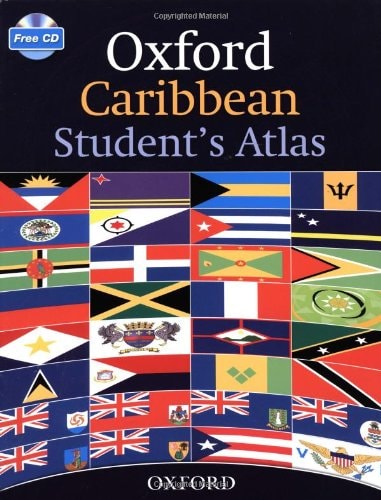
Oxford Caribbean Student's Atlas
0
0
As an Amazon Associate and affiliate partner, Menrva Books earns from qualifying purchases. Learn more
Author Description
This new atlas contains comprehensive coverage of the countries and oceans of the Caribbean and includes up-to-date statistics. It includes clear thematic, topographic maps of all the Caribbean Islands and uses satellite images to enhance and clarify map details. Easy to use features include a multi-access contents page, clear explanations of graphics and flags of the Caribbean at a usable size. A CD-ROM includes digital versions of all the maps in the atlas.
Menrva's Summary
THE THESIS
This atlas serves as a comprehensive geographical reference tool designed to provide students with accurate, up-to-date spatial data regarding the Caribbean region. Wilson Wiegand compiles a collection of thematic and topographic maps, supplemented by satellite imagery, to assist learners in understanding the physical and political landscape of the Caribbean islands and surrounding oceans. The work functions as a structured educational resource, integrating traditional cartography with modern digital accessibility.
THE SCOPE MAP
What You Will Find
- Topographic and thematic maps covering all Caribbean islands and oceans.
- Integrated satellite imagery to provide visual context and detail for map features.
- A multi-access contents page and clear graphical explanations of regional flags.
- A companion CD-ROM containing digital versions of all included maps for classroom or individual use.
THE AUTHORITY PERSPECTIVE
Educators and students frequently utilize this text as a foundational resource for regional geography studies due to its clear layout and accessible data. Experts highlight the inclusion of the digital CD-ROM as a significant benefit for modern classroom integration and visual learning.
Page Count:
176
Publication Date:
2011-07-21
Publisher:
Oxford Schools
ISBN-10:
0198310803
ISBN-13:
9780198310808
Geography
Education
Reference
New Used & Rental Textbooks
Atlases & Maps
Caribbean
Atlas
Community Tags
Similar Books