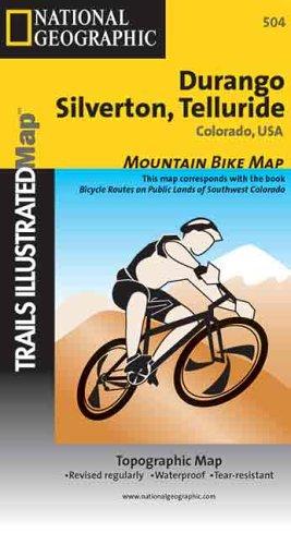
National Geographic Durango, Silverton, Telluride, Colorado, USA Trails Illustrated Map
0
0
As an Amazon Associate and affiliate partner, Menrva Books earns from qualifying purchases. Learn more
Author Description
null
Menrva's Summary
THE THESIS
THE THESIS
This map details the extensive trail systems and geographical features of the Durango, Silverton, and Telluride regions in Colorado, USA. It is designed to provide outdoor enthusiasts with comprehensive navigational information for hiking, biking, and exploring the rugged terrain. The map highlights key points of interest, elevation contours, and recreational opportunities within this popular mountain destination.
THE SCOPE MAP
- Detailed topographic maps of the Durango, Silverton, and Telluride areas.
- Coverage of numerous hiking, biking, and recreational trails.
- Information on points of interest, including natural landmarks and historical sites.
- Elevation contours and shaded relief for accurate terrain representation.
- Key for symbols and trail classifications.
THE AUTHORITY PERSPECTIVE
The Authority Perspective: As a product of the National Geographic Society, this map is expected to adhere to high standards of cartographic accuracy and detail. The Trails Illustrated series is known for its durable, waterproof construction and comprehensive coverage of outdoor recreation areas. This map likely serves as an indispensable tool for visitors and locals navigating the complex trail networks and varied landscapes of southwestern Colorado.
Page Count:
0
Publication Date:
2001-01-01
ISBN-10:
0925873934
ISBN-13:
9780925873934
Non-Fiction
Travel
Art
Outdoors
Maps
Hiking
Colorado
Community Tags
Similar Books