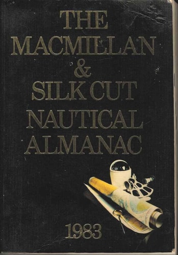
The Macmillan & Silkcut Nautical Almanac 1983
0
0
As an Amazon Associate and affiliate partner, Menrva Books earns from qualifying purchases. Learn more
Author Description
This updated annual reference for all yachtsmen is useful for all coastal navigation around the British Isles and the coasts of Belgium, Germany, Ireland and the Atlantic and Channel coasts of France. With the growing interest in electronic devices, space has been given to "INMARSAT", the world-wide satellite communication system, terminals for which are now becoming a practical possibility in even the smallest yacht. Information on a miniature radiotelex receiver - "NAVTEX" is also included which in turn leads to descriptions of the various types of navigational warnings that are broadcast - general world-wide systems, navigational warnings used in the UK, and those of the European countries within our area of coverage. In chapter 10 there is an added page on "English Channel Waypoints" intended to facilitate navigational planning for cross-Channel passages. In addition improved coverage has been given to 13 harbours which were previously either minor harbours or anchorages. Dick Hewitt was captain of the Navy sailing team and editor of the magazine "Motor Boat and Yachting from 1972-1979. Tim Lees-Spalding joined the Navy in 1939 and has since sailed all over the world.
Menrva's Summary
THE THESIS
This annual reference aims to provide yachtsmen with comprehensive navigational data for coastal waters around the British Isles and adjacent European coastlines. The book addresses the evolving needs of modern navigation by incorporating information on emerging electronic communication systems like INMARSAT and NAVTEX, alongside traditional navigational warnings and detailed harbor information. The authors, drawing on extensive naval and editorial experience, present a practical guide for safe and efficient passage planning.
THE SCOPE MAP
- Coverage of coastal navigation around the British Isles and the coasts of Belgium, Germany, Ireland, and the Atlantic and Channel coasts of France.
- Detailed information on INMARSAT, the global satellite communication system, and its application for yachts.
- Explanation of NAVTEX, a miniature radiotelex receiver, and descriptions of various navigational warning broadcasts (worldwide, UK, and European).
- An added page on 'English Channel Waypoints' to facilitate navigational planning for cross-Channel passages.
- Improved coverage of 13 previously minor harbors or anchorages.
- Biographical information on authors Dick Hewitt (former captain of the Navy sailing team and editor of 'Motor Boat and Yachting') and Tim Lees-Spalding (extensive global sailing experience).
THE AUTHORITY PERSPECTIVE
This almanac serves as a practical, updated annual reference for yachtsmen navigating the coastal waters of the British Isles and nearby European regions. It reflects the practical concerns of its intended audience by integrating information on new electronic navigation and communication technologies alongside essential traditional data. The inclusion of specific waypoint information for the English Channel and enhanced coverage of smaller harbors indicates a focus on detailed, actionable guidance for sailors.
Page Count:
869
Publication Date:
1982-01-01
Publisher:
Macmillan
ISBN-10:
0333330609
ISBN-13:
9780333330609
Non-Fiction
Maritime
Almanac
Reference
Community Tags
Similar Books