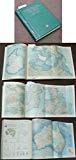
Atlas of the Bahamas
0
0
As an Amazon Associate and affiliate partner, Menrva Books earns from qualifying purchases. Learn more
Author Description
No description available.
Menrva's Summary
THE THESIS
This volume provides a comprehensive cartographic and geographical survey of the Bahamian archipelago. Compiled by the editorial team at Collins-Longman, the atlas utilizes standardized mapping techniques to document the physical topography, political boundaries, and regional infrastructure of the islands. It serves as a foundational reference tool for understanding the spatial organization and environmental features of the region during the early 1970s.
THE SCOPE MAP
What You Will Find
- Detailed topographical maps of the major and minor islands within the Bahamas.
- Data regarding regional climate patterns and coastal geography.
- Political and administrative boundary demarcations.
- Cartographic representations of maritime routes and island infrastructure.
THE AUTHORITY PERSPECTIVE
The work functions as a standard reference text, providing a clear and accessible visual record of the region's geography. Its utility lies in its systematic approach to mapping, offering a reliable resource for students and researchers interested in the historical landscape of the Bahamas.
Page Count:
48
Publication Date:
1971-01-01
Publisher:
Collins-Longman Atlases
ISBN-10:
0003601943
ISBN-13:
9780003601947
Travel
Geography
Caribbean
Bahamas
Atlases
Cartography
Reference
Community Tags
Similar Books