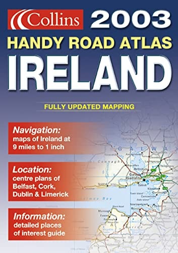
Handy Road Atlas Ireland
0
0
As an Amazon Associate and affiliate partner, Menrva Books earns from qualifying purchases. Learn more
Author Description
9 miles to 1 inch 1:570,240 Handy format route planning atlas in full colour complete with tourist information centre and office listing.MAIN FEATURES Digitally derived, fully updated route planning atlas Covers the whole of Ireland at 9 miles to 1 inch Beautifully designed mapping with colour classified roads and subtle layered height tintingINCLUDES All Ireland route planning maps Dublin, Belfast, Cork and Limerick town centre plans List of tourist information centres Description of places of interest Full index to place names Information on Airports, Ferries and Radio Stations Mileage ChartAREA OF COVERAGE The whole of IrelandWHO THE PRODUCT IS AIMED AT Ideal for the resident, visitor and tourist who travel extensively around Ireland.
Menrva's Summary
THE THESIS
This atlas provides a comprehensive, portable navigational framework for travelers and residents navigating the road networks of Ireland. The publication utilizes digitally derived cartographic data to offer a detailed overview of the island's infrastructure, including major routes and urban centers. It serves as a practical tool for route planning, integrating geographical data with essential tourist and logistical information.
THE SCOPE MAP
What You Will Find
- Full-color road mapping at a scale of 9 miles to 1 inch (1:570,240).
- Detailed town center plans for Dublin, Belfast, Cork, and Limerick.
- Comprehensive index of place names and a mileage chart for distance estimation.
- Practical logistical data including airport locations, ferry terminals, and radio station frequencies.
THE AUTHORITY PERSPECTIVE
The subject matter points to a highly functional, utilitarian reference tool designed for ease of use during transit. Its inclusion of specific urban plans and tourist infrastructure suggests a focus on practical navigation for both local residents and visitors.
Page Count:
64
Publication Date:
2004-01-01
Publisher:
Harper Collins
ISBN-10:
0004488644
ISBN-13:
9780004488646
Travel
Reference
Atlases & Maps
Europe
Maps
Ireland
Geography
Community Tags
Similar Books