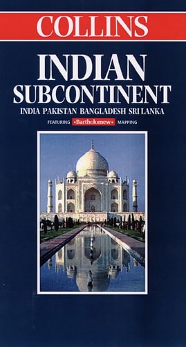
Collins Indian Subcontinent
0
0
As an Amazon Associate and affiliate partner, Menrva Books earns from qualifying purchases. Learn more
Author Description
Featuring Bartholomew Mapping. Includes Inset Map Showing Continuation Of Main Map To The East, 5 Inset Maps Showing Delhi, Calcutta, Karachi, Mumbi, And Chennai, And Inset Map Of The Andaman Islands. Relief Shown By Gradient Tints And Spot Heights. Depths Shown By Contours And Gradient Tints. Lw9691. Panel Title. Cover Includes Col. Ill., 2 Maps Showing Areas Covered, And List Of Titles In The Series.
Menrva's Summary
THE THESIS
This map provides a comprehensive cartographic representation of the Indian Subcontinent designed to facilitate navigation and geographical study for travelers and researchers. The map utilizes the established cartographic expertise of Bartholomew to present a detailed visual guide to the region. It integrates topographical data, including relief and depth, alongside specific urban inset maps to provide a multi-layered view of the territory.
THE SCOPE MAP
What You Will Find
- Detailed topographical relief shown through gradient tints and spot heights
- Bathymetric data for coastal regions represented by contours and tints
- Specialized inset maps for major metropolitan centers including Delhi, Calcutta, Karachi, Mumbai, and Chennai
- Supplementary cartographic coverage for the Andaman Islands and eastern extensions
THE AUTHORITY PERSPECTIVE
This map is regarded as a standard reference tool for regional navigation, valued for its inclusion of specific urban detail alongside broad geographical coverage. The technical presentation suggests a focus on clarity and utility for those requiring precise spatial orientation within the Indian Subcontinent.
Page Count:
0
Publication Date:
1864-01-01
Publisher:
Collins Publishers
ISBN-10:
0004487648
ISBN-13:
9780004487649
Travel
Geography
Asia
Maps
Reference
Community Tags
Similar Books