Collins Foundation Atlas
0
0
As an Amazon Associate and affiliate partner, Menrva Books earns from qualifying purchases. Learn more
Author Description
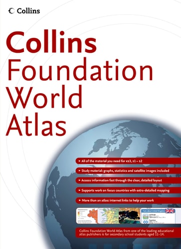
Completely new, extended and rebranded edition of the leading Collins Longman Foundation Atlas. Perfectly designed for Key Stage 3 students to support and motivate them in geographical and mapping skills. Collins Foundation Atlas is a completely new and extended edition of the highly successful Collins Longman Foundation Atlas. It features 88 pages of clear, easy to read maps, satellite images, an atlas skills section and hundreds of statistics. It is an introductory atlas for secondary school students aged 11-14 designed to help students develop map, atlas and data handling skills. The content adheres closely to the requirements of the National curriculum and incorporates results of classroom testing. The Foundation Atlas has a clear and accessible layout to motivate pupils of all abilities at Key Stage 3 and S1-S2. An easy to follow introductory 'map and atlas skills' section, useful for both teacher and pupil, is followed by clear, easy to read reference maps presented with locator maps, fact boxes and flags, descriptive text, detailed map keys and photos. Carefully selected focus country studies include mapping on contrasting regions and special topics. Key country-by-country statistics are listed in a separate section and the index includes full latitude and longitude values. Colour coding of the titling and marginalia aids the identification of the sections within the atlas. The world section covers all the global issues required by the National Curriculum e.g. climate, population, earthquakes and volcanoes and a new map of Biomes.
Menrva's Summary
THE THESIS
This atlas serves as a foundational pedagogical tool designed to cultivate essential geographical literacy and data-handling proficiency in students aged 11 to 14. Developed by HarperCollins to align with National Curriculum standards, the text integrates cartographic reference materials with statistical analysis to provide a structured learning environment for secondary school pupils. The framework emphasizes accessibility and visual clarity, utilizing classroom-tested layouts to support diverse learning abilities in geography and earth sciences.
THE SCOPE MAP
What You Will Find
- 88 pages of reference maps, satellite imagery, and thematic global data.
- An introductory module dedicated to map and atlas skills for teachers and students.
- Case studies focusing on contrasting regions and specific biomes.
- Comprehensive statistical appendices including latitude and longitude indexing.
THE AUTHORITY PERSPECTIVE
The material suggests a highly structured, utilitarian approach to geographical education, prioritizing clarity and curriculum alignment for the Key Stage 3 demographic. Its design indicates a focus on classroom utility, providing a standardized reference point for students developing foundational spatial and analytical skills.
Page Count:
88
Publication Date:
2005-01-01
Publisher:
Harper Collins
ISBN-10:
0007195478
ISBN-13:
9780007195473
Reference
ScienceMathematics
Atlases & Maps
Atlases
Geography
Cartography
Education
Community Tags
Similar Books