Handy Street Map London
0
0
As an Amazon Associate and affiliate partner, Menrva Books earns from qualifying purchases. Learn more
Author Description
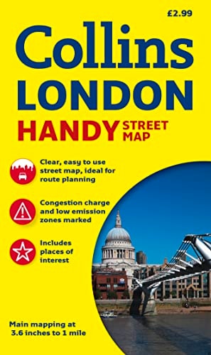
1:15,840 (4 inches to 1 mile).Clear tourist mapping with selected index presented as popular handy map format.MAIN FEATURESThe extremely popular handy map format is exceptionally easy to use the pages open up almost like a book. It has been laminated both sides for extra durability and inserted into a plastic wallet.INCLUDES Clear uncluttered mapping. London Underground Map on the back cover. Index to selected streets, places of interest, theatres and cinemas.AREA OF COVERAGEFrom Regents Park and Kings Cross in the north to Vauxhall in the south and from Kensington in the west to the Tower of London in the East.
Menrva's Summary
THE THESIS
This map provides a portable, durable, and clear navigational tool for tourists and residents navigating the central districts of London. The publisher, HarperCollins, utilizes a standard cartographic scale of 1:15,840 to balance detail with readability. The document is designed for high-frequency use in urban environments, incorporating physical reinforcements to withstand outdoor conditions.
THE SCOPE MAP
What You Will Find
- Detailed street-level cartography covering central London from Regents Park to Vauxhall.
- A supplementary London Underground map located on the back cover for transit planning.
- An index of selected streets, landmarks, theaters, and cinemas for quick reference.
- A laminated, fold-out format designed for physical durability and ease of handling.
THE AUTHORITY PERSPECTIVE
The subject matter points to a practical, utilitarian resource intended for short-term visitors or those requiring a quick-reference physical map. The inclusion of lamination and a protective wallet suggests a focus on longevity and ease of use in varied weather conditions.
Page Count:
0
Publication Date:
2009-07-01
Publisher:
Collins
ISBN-10:
0007274394
ISBN-13:
9780007274390
Travel
Guidebooks
London
Reference
Maps
Community Tags
Similar Books