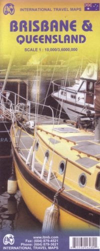
Brisbane & Queensland (Australia) 1:10,000 / 1:3,600,000 Street & Travel Map
0
0
As an Amazon Associate and affiliate partner, Menrva Books earns from qualifying purchases. Learn more
Author Description
Double sided street plan and regional travel map. Brisbane map legend includes Brisbane commuter rail lines, bus-way lines, inter-city rail lines, city-cat ferry routes, inner-city ferry routes, cross-river ferry routes, ferry wharfs/stations, parks/plazas, accommodations, churches, synagogues, points of interest, museums, shopping centres, bike routes, airport train stops, bus stations. Includes inset map of Brisbane and region, Brisbane regional transit network. Queensland map distinguishes roads ranging from motorways to other roads (untarred). Legend includes tracks, trails, railways, car ferry routes, coral reefs, restricted areas, Aboriginal lands, national parks/nature reserves, fishing, beaches, points of interest, Aboriginal settlements, castles/palaces, international/regional airports. Includes inset map of Sydney. Indexed.
Menrva's Summary
THE THESIS
This map provides detailed cartographic information for both urban navigation within Brisbane and regional travel across Queensland, Australia. It utilizes a dual-sided format to present a street-level plan of Brisbane and a broader overview of Queensland's road networks and points of interest. The map's comprehensive legends are designed to aid travelers in understanding various transportation routes, geographical features, and significant locations.
THE SCOPE MAP
- What You Will Find:
- Detailed street plan of Brisbane with extensive transit and landmark information.
- Regional travel map of Queensland highlighting road classifications, national parks, and points of interest.
- Legends detailing commuter rail, bus-way, ferry routes, and road networks.
- Inset maps for Brisbane and its region, and Sydney.
THE AUTHORITY PERSPECTIVE
This map is a practical tool for travelers and residents, offering detailed navigational aids for both city exploration and inter-regional journeys. Its dual-sided format efficiently consolidates information, making it a comprehensive resource for understanding Queensland's geography and transportation infrastructure. The inclusion of specific transit lines and diverse points of interest suggests a focus on utility for tourists and commuters alike.
Page Count:
2
Publication Date:
2008-07-01
Publisher:
ITMB Publishing Ltd.
ISBN-10:
1553416260
ISBN-13:
9781553416265
Non-Fiction
Travel
Queensland
Australia
Maps
Community Tags
Similar Books