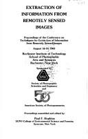
Extraction of Information from Remotely Sensed Images
0
0
As an Amazon Associate and affiliate partner, Menrva Books earns from qualifying purchases. Learn more
Author Description
Author description coming soon. We're reaching out to them in the ether...
Menrva's Summary
THE THESIS
THE THESIS
This book investigates the challenges and advancements in extracting meaningful information from remotely sensed imagery, a critical task for fields ranging from environmental monitoring to urban planning. Drawing from a 1983 conference, the work compiles papers that explore various methodologies and algorithms developed to process and interpret data captured by sensors on aircraft and satellites. The primary argument presented is that sophisticated computational techniques are essential for unlocking the full potential of remote sensing data, moving beyond simple visual interpretation to quantitative analysis.
THE SCOPE MAP
- What You Will Find:
- Methodologies for feature extraction from satellite and aerial imagery.
- Algorithms for image classification and segmentation.
- Case studies on applications in environmental and resource management.
- Discussions on sensor technology and data acquisition challenges.
THE AUTHORITY PERSPECTIVE
THE AUTHORITY PERSPECTIVE As a collection of papers from a 1983 conference, this volume likely represents a snapshot of the state-of-the-art in remote sensing information extraction at that time. The technical nature of the subject suggests it would appeal to researchers and practitioners in fields such as photogrammetry, geographic information systems, and computer vision. The focus on specific techniques indicates a readership seeking detailed, methodological insights rather than broad overviews.
Page Count:
170
Publication Date:
1984-01-01
ISBN-10:
0937294551
ISBN-13:
9780937294550
Science & Technology
Non-Fiction
Computer Vision
Remote sensing
Image Processing
Community Tags
Similar Books