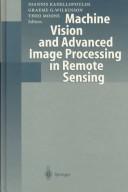
Machine Vision and Advanced Image Processing in Remote Sensing
0
0
As an Amazon Associate and affiliate partner, Menrva Books earns from qualifying purchases. Learn more
Author Description
Author description coming soon. We're reaching out to them in the ether...
Menrva's Summary
THE THESIS
This book investigates the application of machine vision and advanced image processing techniques to the field of remote sensing. It explores how these computational methods can extract meaningful information from satellite and aerial imagery, addressing challenges such as noise reduction, feature extraction, and classification. The work is structured to provide a comprehensive overview of the methodologies and their practical implementations in analyzing Earth's surface and atmosphere.
THE SCOPE MAP
- Fundamentals of machine vision algorithms relevant to remote sensing data.
- Advanced image processing techniques for enhancing and analyzing satellite imagery.
- Methods for feature extraction and object recognition in remote sensing applications.
- Classification algorithms for land cover, land use, and environmental monitoring.
- Case studies demonstrating the application of these techniques in various remote sensing scenarios.
- Discussion of challenges and future directions in the field.
THE AUTHORITY PERSPECTIVE
The book is likely regarded as a technical reference for researchers and practitioners in remote sensing and image processing. Its focus on established methodologies suggests it serves as a foundational text for understanding the integration of machine vision into geospatial analysis. The detailed exploration of algorithms and applications points to its utility for those needing to implement or develop such systems. The publication date indicates it covers the state of the art as of the late 1990s, providing historical context for current advancements.
Page Count:
335
Publication Date:
1999-01-01
ISBN-10:
3540655719
Science
Non-Fiction
Remote sensing
Image Processing
Computer Vision
Community Tags
Similar Books