Geography - Aerial Geography (7-11)
0
0
As an Amazon Associate and affiliate partner, Menrva Books earns from qualifying purchases. Learn more
Author Description
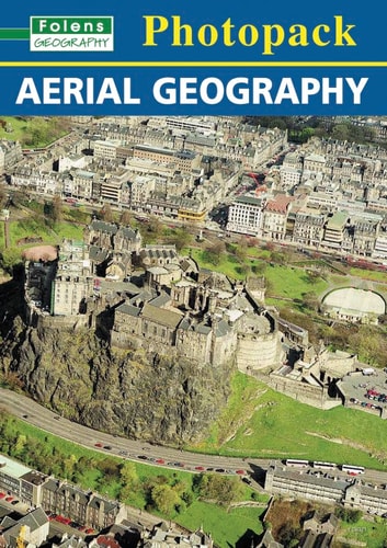
Stunning visual images of geographical features, as seen from the air. The Photopack also contains an A2 poster for the classroom, featuring some of the images, and a teacher resource book, containing background information, learning intentions, starting points, key questions and activities for each of the durable A4 photographs. Topics include: * islands * land masses * coastal areas * towns * ports * human geography
Menrva's Summary
THE THESIS
This resource explores the Earth's surface through striking aerial photography, designed for educational purposes. It provides a visual foundation for understanding geographical concepts, focusing on diverse landscapes and human impact, suitable for students aged 7-11. The accompanying materials offer structured learning opportunities to deepen comprehension of the presented visual data.
THE SCOPE MAP
- Stunning aerial photographs of geographical features.
- An A2 poster suitable for classroom display.
- A teacher resource book with background information.
- Learning intentions, starting points, and key questions for each photograph.
- Suggested activities for classroom use.
- Topics covered: islands, land masses, coastal areas, towns, ports, and human geography.
THE AUTHORITY PERSPECTIVE
This educational resource is designed to engage young learners with geography through compelling aerial imagery. The inclusion of a classroom poster and detailed teacher materials suggests a focus on structured learning and interactive engagement. The comprehensive approach aims to provide educators with the tools to explore diverse geographical topics effectively with students in the primary age range.
Page Count:
16
Publication Date:
2005-02-15
Publisher:
Folens
ISBN-10:
1843036371
ISBN-13:
9781843036371
Photography
Non-Fiction
Education
Geography
Earth Science
Community Tags
Similar Books