The Thames: A History from the Air
0
0
As an Amazon Associate and affiliate partner, Menrva Books earns from qualifying purchases. Learn more
Author Description
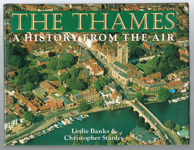
Lavishly illustrated with 150 full-color aerial photographs--all taken by Christopher Stanley, one of Britain's foremost aerial photographers, and Leslie Banks--this volume takes readers on an informative journey along Britain's most historic river. We travel from a Roman villa in Oxfordshire to the palace at Hampton Court, from the crossing of the Thames by the prehistoric Ridgeway path to Brunel's railway bridge at Maidenhead, and from an abandoned medieval village to new housing on the Isle of Dogs. Armchair travellers, Anglophiles, and history buffs will all be delighted by this colorful oversized volume.
Menrva's Summary
THE THESIS
How does the aerial perspective reveal the layered historical and architectural evolution of the River Thames? Christopher Stanley, a prominent aerial photographer, and Leslie Banks utilize high-altitude visual documentation to examine the physical development of the Thames corridor. By pairing contemporary photography with historical context, the authors argue that the river serves as a continuous record of British civilization, spanning from prehistoric pathways to modern urban expansion. The text functions as a visual survey of the river's changing landscape over time.
THE SCOPE MAP
What You Will Find
- 150 full-color aerial photographs documenting the Thames riverbank.
- Historical analysis of sites ranging from Roman villas to Victorian engineering projects.
- Comparative views of rural, medieval, and contemporary urban development.
Scope Limits
- The book does not provide an exhaustive archaeological survey of every site mentioned.
- It focuses primarily on visual documentation rather than deep academic historiography.
THE AUTHORITY PERSPECTIVE
Critics and readers frequently note the high quality of the photography as the primary value of this volume. It is widely regarded as a visual reference for those interested in British topography and historical geography.
Page Count:
192
Publication Date:
1990-11-22
Publisher:
Oxford University Press
ISBN-10:
0192158953
ISBN-13:
9780192158956
Travel
Non-Fiction
History
Photography
British History
Geography
Community Tags
Similar Books