Collins Road Atlas: Britain & Ireland
0
0
As an Amazon Associate and affiliate partner, Menrva Books earns from qualifying purchases. Learn more
Author Description
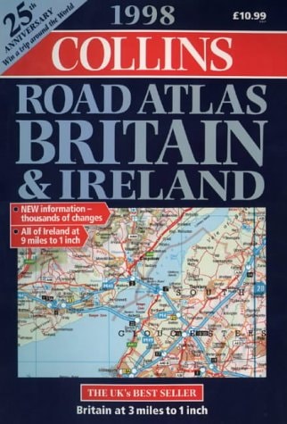
This road atlas is of scale three miles to one inch, with Northern Ireland at five miles to one inch. It includes a comprehensive section of London mapping, 57 indexed town plans, urban area maps, a cover flap with symbols, route-planning maps, port and airport maps and Channel Tunnel plans.
Menrva's Summary
THE THESIS
This atlas serves as a comprehensive navigational reference for motorists traveling across Britain and Ireland during the late 1990s. The publication provides detailed cartographic data designed to facilitate route planning and urban navigation, utilizing standardized scales to ensure accuracy for long-distance travel and local transit. By integrating regional maps with specific town plans and infrastructure details, the work functions as a primary tool for spatial orientation and logistical preparation.
THE SCOPE MAP
What You Will Find
- Cartographic mapping at a scale of three miles to one inch for Britain and five miles to one inch for Northern Ireland.
- A dedicated section featuring comprehensive mapping of London and 57 indexed town plans.
- Specialized inserts for port locations, airport access, and Channel Tunnel infrastructure.
- Integrated route-planning maps and a reference cover flap detailing standardized cartographic symbols.
THE AUTHORITY PERSPECTIVE
This atlas represents a standard reference tool for its era, prioritizing functional utility and geographic coverage for the British and Irish road networks. The inclusion of urban area maps and transit hubs suggests a focus on the practical needs of drivers navigating complex metropolitan environments.
Page Count:
272
Publication Date:
1997-10-06
Publisher:
HarperCollins Publishers
ISBN-10:
0004485831
ISBN-13:
9780004485836
Travel
Europe
Maps
Geography
United Kingdom
Reference
Ireland
Community Tags
Similar Books