Photographic Atlas of Sussex
0
0
As an Amazon Associate and affiliate partner, Menrva Books earns from qualifying purchases. Learn more
Author Description
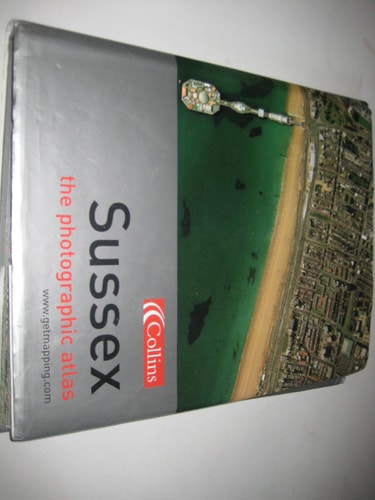
This revealing atlas covers the whole of the county of Sussex. It combines the vertical aerial photography of Getmapping.com with Collins' street and road mapping - a combination of photography and cartography. already possess a personal stake in this book - within its pages you will be able to find your house, perhaps locate your car parked in the street, trace your route to work, and visit some of your favourite places. ground, discover surprising links between unconnected areas, find large areas of greenery that you never knew existed, and explore new neighbourhoods for the first time. meaning you can cross-reference quickly between the two elements; both photography and cartography are map accurate, as the photography has been geo-corrected, a process that removes the distortions in the original aerial photography; and throughout the whole book the grid interval is 500 metres, so that distances can be accurately assessed.
Menrva's Summary
THE THESIS
This atlas investigates the utility of integrating high-resolution aerial photography with traditional cartographic road mapping to provide a comprehensive visual and spatial record of the county of Sussex. The authors, Getmapping, utilize geo-corrected aerial imagery alongside standard street-level data to create a dual-layered reference tool. By aligning these two distinct data sets, the work allows users to bridge the gap between abstract map representations and the physical reality of the landscape.
THE SCOPE MAP
What You Will Find
- Full coverage of the county of Sussex using vertical aerial photography.
- Integrated street and road mapping provided by Collins.
- Geo-corrected imagery to ensure spatial accuracy and remove photographic distortion.
- A consistent 500-metre grid system for accurate distance assessment across all pages.
THE AUTHORITY PERSPECTIVE
The subject matter points to a highly practical, technical reference tool designed for residents, planners, and local historians interested in spatial analysis. The framing suggests a focus on precision and utility, prioritizing the seamless cross-referencing of photographic data with traditional map layouts.
Page Count:
224
Publication Date:
2003-01-01
Publisher:
Collins
ISBN-10:
0007172982
ISBN-13:
9780007172986
Travel
Road maps
Cartography
Great Britain
Sussex
Germany
Atlases
Subjects & Themes
Earth Sciences
Europe
Photography
Aerial
Reference
Science
Geography
Community Tags
Similar Books