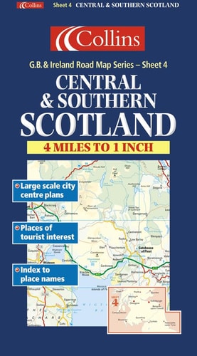
Central and Southern Scotland
0
0
As an Amazon Associate and affiliate partner, Menrva Books earns from qualifying purchases. Learn more
Author Description
These interesting and attractive maps of the British Isles not only guide you through specific destinations, they inform you about the local heritage of these culturally rich areas. Whether you're looking for a map of Scottish Castles, the origins of Irish family names or a detailed road map of England, these full-color maps and atlases are perfect for exploring Great Britain and Ireland's fascinating past and present.
Menrva's Summary
THE THESIS
This publication serves as a navigational and cultural reference tool designed to assist travelers in exploring the geography and heritage of Central and Southern Scotland. The work is produced by Collins, a publisher with a long-standing history in cartography and reference materials. It integrates detailed topographical data with historical context to provide a comprehensive overview of the region's landscape and points of interest.
THE SCOPE MAP
What You Will Find
- Detailed road and topographical mapping of Central and Southern Scotland
- Historical markers and heritage site locations
- Cultural information regarding local landmarks and regional history
- Visual cartographic data presented in full-color format
THE AUTHORITY PERSPECTIVE
The work functions as a practical, utilitarian resource for those requiring spatial orientation and historical context within the specified Scottish regions. Its focus on combining navigational utility with cultural heritage makes it a standard reference for regional exploration.
Page Count:
0
Publication Date:
1999-11-01
Publisher:
Langenscheidt Publishing Group
ISBN-10:
0004489829
ISBN-13:
9780004489827
Travel
Geography
Maps
Scotland
Reference
Road maps
Community Tags
Similar Books