Majorca: Holiday Map
0
0
As an Amazon Associate and affiliate partner, Menrva Books earns from qualifying purchases. Learn more
Author Description
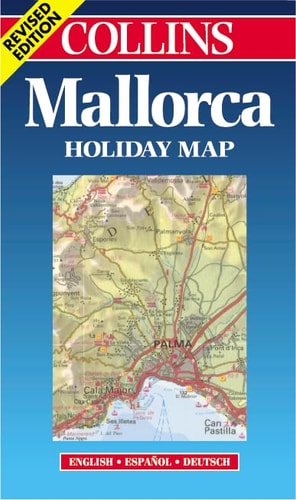
Revised edition of road map of the Mediterranean island of Mallorca with tourist information and indexes to places of interest and hotels. Scale 1: 175 000 (1cm to 1.75 kms / 1 inch to 2.8 miles) INCLUDES Plan of Palma, Playa del Palma (Can Pastilla and S'Arenal) and West Palma Bay (Magaluf, Palma Nova, Cala Major) Gazetteer of places of interest and Historical Chart AREA OF COVERAGE Island of Mallorca WHO THE PRODUCT IS AIMED AT Tourist and package holiday maker OTHER PRODUCTS IN THE SERIES Ibiza Menorca Algarve Plus a range of maps covering most popular holiday destinations
Menrva's Summary
THE THESIS
This publication provides a comprehensive cartographic and informational resource designed to assist travelers in navigating the geography and tourist infrastructure of Mallorca. The Collins editorial team utilizes standardized cartographic data to present a clear, scaled representation of the island's road networks and points of interest. By integrating a gazetteer and specific urban plans, the work functions as a practical navigational tool for visitors requiring spatial orientation and logistical planning during their stay.
THE SCOPE MAP
What You Will Find
- Detailed road map of Mallorca at a scale of 1:175,000
- Inset plans for Palma, Playa del Palma, and West Palma Bay
- Comprehensive indexes for hotels and local landmarks
- Historical chart and gazetteer of key locations
THE AUTHORITY PERSPECTIVE
The material suggests a functional, utilitarian approach to travel navigation, prioritizing clarity and ease of use for the casual tourist. Its focus on standardized scale and indexed information indicates a design intended for quick reference in a physical, on-the-ground setting.
Page Count:
2
Publication Date:
2000-07-25
Publisher:
Harper Collins
ISBN-10:
0004489527
ISBN-13:
9780004489520
Travel
Spain
Europe
Reference
Maps
Balearic islands
Community Tags
Similar Books