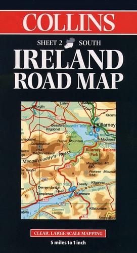
Collins Ireland Road Map: Clear Large-Scale Mapping; 5 Miles to 1 Inch
0
0
As an Amazon Associate and affiliate partner, Menrva Books earns from qualifying purchases. Learn more
Author Description
No description available.
Menrva's Summary
THE THESIS
This reference work provides a comprehensive and legible cartographic representation of the Irish road network to facilitate navigation and route planning. Edited by Mike Cottingham, the volume utilizes a large-scale format to ensure that secondary roads and regional infrastructure remain visible to the user. The data is structured to prioritize clarity and ease of use for motorists traversing the island.
THE SCOPE MAP
What You Will Find
- Detailed road network mapping at a scale of 5 miles to 1 inch
- Comprehensive coverage of primary and secondary routes across Ireland
- Cartographic symbols for major landmarks and geographical features
- Indexing for quick location of towns and cities
THE AUTHORITY PERSPECTIVE
This map is regarded as a functional tool for travelers requiring a physical, large-scale reference for navigating the Irish landscape. The focus on high-contrast, clear cartography suggests it is intended for practical use by drivers who prefer traditional paper-based navigation aids over digital alternatives.
Page Count:
0
Publication Date:
1998-03-02
Publisher:
Collins
ISBN-10:
0004487788
ISBN-13:
9780004487786
Travel
Atlases & Maps
Europe
Reference
Ireland
Maps
Geography
Community Tags
Similar Books