Greater London Street Atlas
0
0
As an Amazon Associate and affiliate partner, Menrva Books earns from qualifying purchases. Learn more
Author Description
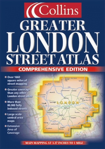
1:10,000 Central area, 1:20,000 Main area, 1:50,000 Urban maps, 1:162,600 Route Planning maps.MAIN FEATURES Thousands of updates in this revised edition Largest area of coverage of any London Street Atlas Durable hardback binding in A4 format Area of over 4,300 km² covered by main street mapping Mapping at four main scales ranging from route planning maps to large scale central area mapsINCLUDES Theatres, cinemas, shopping and underground maps Full index to street names and places of interest M25 mileage chart Colour coded roads, buildings and land useAREA OF COVERAGE Extends from Welwyn Garden City in the north to Gatwick Airport in the south and from Windsor in the west to Gravesend in the east.WHO THE PRODUCT IS AIMED AT This is the definitive reference atlas for London and the surrounding area presented in a durable hardback binding.OTHER PRODUCTS IN THE SERIES This product can also be purchased as a paperback edition: 0 00 449061 4.
Menrva's Summary
THE THESIS
This atlas serves as a comprehensive, multi-scale cartographic reference tool designed to provide accurate navigation and spatial orientation for the Greater London area. The publishers, HarperCollins, utilize extensive geographic data to compile a detailed street-level guide that spans over 4,300 square kilometers. The work organizes complex urban topography into a structured, hierarchical format that assists users in both long-distance route planning and precise local navigation.
THE SCOPE MAP
What You Will Find
- Multi-scale mapping ranging from 1:10,000 for central districts to 1:162,600 for regional route planning.
- Comprehensive indexing of street names, theaters, cinemas, and public transport hubs.
- Specialized data including M25 mileage charts and color-coded land use indicators.
- Extensive geographic coverage extending from Welwyn Garden City to Gatwick Airport and Windsor to Gravesend.
THE AUTHORITY PERSPECTIVE
The subject matter points to a highly functional, technical resource intended for professional drivers, logistics planners, and residents requiring granular spatial data. The inclusion of diverse scales and specific transit information suggests a focus on utility and navigational reliability for the Greater London region.
Page Count:
432
Publication Date:
2000-01-01
Publisher:
Collins
ISBN-10:
0004490622
ISBN-13:
9780004490625
Travel
London
Subjects
Geography
Cartography
Reference
Maps
Community Tags
Similar Books