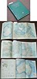
Atlas of the United States
0
0
As an Amazon Associate and affiliate partner, Menrva Books earns from qualifying purchases. Learn more
Author Description
An indispensable item in any modern professional or personal library, the Atlas of the United States offers a closer look at the oldest, richest, and most populous country on the continent. Opening with two pages of the latest statistics, this atlas provides a broad overview of a multicultural and diverse nation taking its first steps into a new century. The heart of this comprehensive volume is a unique thematic section covering physical, historic, urban, economic, social, and cultural topics ranging from environmental change to religious practice, and indigenous peoples to migration patterns. Accompanied by a balanced combination of informative text and instructive charts and graphs, these newly drawn maps seek to explain the dynamic forces shaping the United States of America.The thematic section is followed by a spectacular two-page satellite image of the lower 48 states and several regional maps including a full page for the US Pacific islands plus dozens of larger-scale maps of urban areas. A useful, illustrated gazetteer offers still more precision with charts of census data and descriptions of the history, geography, and industry of each state and its capital. In combination, these components transform the new Atlas of the United States into a home reference unsurpassed in quality that is equal parts study source and travel guide. All of this is facilitated by a comprehensive index with latitude and longitude coordinates and alphanumeric grid references that make finding places effortless. What's more, page number indicators and refined locator windows throughout the atlas allow for easy identification of adjacent map pages.With hundreds of maps rendering every region from Barrow, Alaska to Venice, Florida in layer-colored contours, this atlas is the United States as it hasn't been seen before.
Menrva's Summary
THE THESIS
This volume investigates the complex geographic, social, and economic forces that define the United States of America through a comprehensive cartographic lens. Harm J. de Blij, a distinguished geographer, utilizes his expertise to synthesize vast amounts of spatial data into a cohesive visual and textual framework. The work argues that understanding the nation requires a multi-layered approach, integrating physical terrain with human, historical, and cultural development to provide a holistic view of the country's identity at the turn of the century.
THE SCOPE MAP
What You Will Find
- Thematic mapping covering physical, historic, urban, economic, and social topics.
- Detailed satellite imagery of the lower 48 states and regional map sets.
- Statistical data sets including census information and industry profiles for each state.
- An illustrated gazetteer with latitude and longitude coordinates for precise location identification.
THE AUTHORITY PERSPECTIVE
Experts and educators frequently cite this work as a high-quality reference tool for its balance of technical cartographic precision and accessible thematic analysis. Readers note that the inclusion of both broad regional maps and granular urban data makes it a versatile resource for both academic study and general reference use.
Page Count:
208
Publication Date:
2006-05-11
Publisher:
Oxford University Press
ISBN-10:
0195220447
ISBN-13:
9780195220445
Cartography
Reference
Geography
United States
Atlases
Community Tags
Similar Books