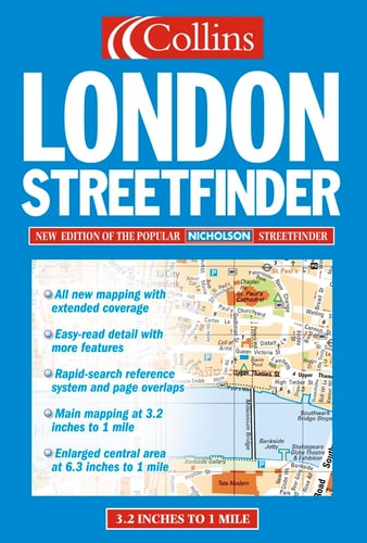
Collins London Streetfinder Atlas
0
0
As an Amazon Associate and affiliate partner, Menrva Books earns from qualifying purchases. Learn more
Author Description
Outer Area 1:20,000 Central Area 1:10,000Clear uncluttered mapping in the well respected Streetfinder style.All the features which have made the Streetfinder such a lively and popular product are retained and clear, full-colour, uncluttered mapping, bold street names on uncased roads, strong background colours for maximum contrast and the easy read grid referencing system.Streetfinder mapping, with its neat, unobtrusive symbols, displays a wealth of important details including car parks, one-way streets, hospitals, schools, police stations, places of worship, all important buildings, tourist features and much much more.INCLUDES London Underground Map Large scale central area mappingAREA OF COVERAGEExtends from Barnet in the north, to Carshalton in the south, and Northolt in the west to Belvedere in the east.
Menrva's Summary
THE THESIS
This atlas provides a comprehensive and highly legible cartographic resource designed to facilitate efficient navigation across the Greater London area. The publication utilizes a standardized grid-referencing system and high-contrast color schemes to ensure clarity for both residents and visitors. By maintaining a consistent scale and uncluttered aesthetic, the work serves as a practical tool for identifying key urban infrastructure and transit points.
THE SCOPE MAP
What You Will Find
- Detailed mapping of Central London at a 1:10,000 scale and Outer London at a 1:20,000 scale.
- Comprehensive coverage extending from Barnet to Carshalton and Northolt to Belvedere.
- Inclusion of the London Underground network map for integrated transit planning.
- Identification of essential urban landmarks including hospitals, police stations, schools, and tourist attractions.
THE AUTHORITY PERSPECTIVE
The Collins Streetfinder series is widely regarded as a standard reference for urban navigation due to its emphasis on high-contrast readability and logical grid organization. The mapping style is consistently praised for its functional design, which prioritizes user accessibility in complex metropolitan environments.
Page Count:
368
Publication Date:
2001-01-01
Publisher:
Collins
ISBN-10:
0004490266
ISBN-13:
9780004490267
Travel
London Greater London
Maps
Reference
Geography
London
Community Tags
Similar Books