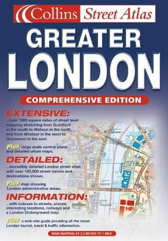
Greater London Street Atlas
0
0
As an Amazon Associate and affiliate partner, Menrva Books earns from qualifying purchases. Learn more
Author Description
1:10,000 Central area, 1:20,000 Main area, 1:50,000 Urban maps, 1:162,600 Route Planning maps. Incredibly detailed street level mapping, with over 40 categories of information, covering 1660 square miles in and around London.
Menrva's Summary
THE THESIS
This atlas serves as a comprehensive cartographic reference designed to provide precise navigational data for the Greater London area. Compiled by the cartographic division of HarperCollins, this volume utilizes multi-scale mapping to assist users in both granular street-level orientation and broader regional route planning. The work organizes vast spatial data into a standardized, accessible format suitable for professional and personal navigation.
THE SCOPE MAP
What You Will Find
- Detailed street-level mapping at a 1:10,000 scale for the central metropolitan area.
- Regional coverage spanning 1,660 square miles of the London urban and suburban landscape.
- Specialized route planning maps at a 1:162,600 scale for long-distance navigation.
- Over 40 distinct categories of geographic information, including transit hubs, landmarks, and infrastructure.
THE AUTHORITY PERSPECTIVE
This atlas is regarded as a standard reference tool for those requiring high-density geographic information within the London metropolitan region. The multi-scale approach provides a functional balance between local detail and regional context for the user.
Page Count:
433
Publication Date:
2002-01-01
Publisher:
Collins
ISBN-10:
0007133464
ISBN-13:
9780007133468
Travel
Maps
Geography
Road maps
Reference
London
Cartography
Community Tags
Similar Books