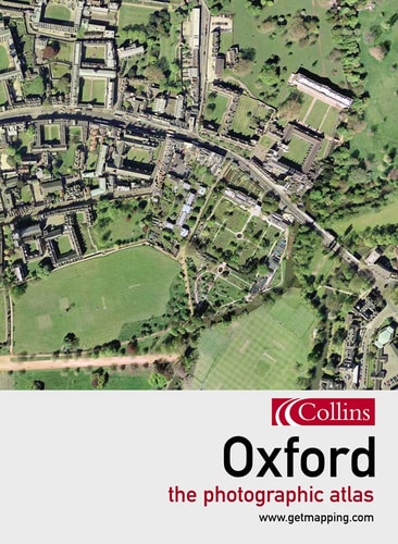
Oxford: The Photographic Atlas
0
0
As an Amazon Associate and affiliate partner, Menrva Books earns from qualifying purchases. Learn more
Author Description
If you live in, work in, or visit Oxford, you will already possess a personal stake in this book - within its pages you will be able to find your house, perhaps locate your car parked in the street, visit some of your favourite places, or simply admire the stunning aerial views of the dreaming spires of Oxford University. Even if you don't know Oxford well, you will find this book fascinating. Packed with tourist information about things to see and do in the city, this is the ideal visual companion to a day or a week in Oxford and the perfect visual memento of your stay. The photographic atlas is easy to use, as the photography and the cartography share the same standard grid system, meaning you can cross-reference quickly between the two elements, allowing you to locate a street or place of interest quickly and accurately.
Menrva's Summary
THE THESIS
This atlas investigates the urban geography and architectural landscape of Oxford through high-resolution aerial photography integrated with standard cartographic grids. The authors, Getmapping, utilize professional aerial survey data to provide a comprehensive visual record of the city. By aligning photographic imagery with traditional map systems, the work serves as a functional tool for both residents and visitors to navigate and identify specific locations within the city limits.
THE SCOPE MAP
What You Will Find
- High-resolution aerial photography of Oxford city streets and landmarks.
- A synchronized grid system for cross-referencing maps and photographs.
- Tourist information regarding local points of interest and attractions.
- Detailed visual documentation of the university architecture and surrounding urban infrastructure.
THE AUTHORITY PERSPECTIVE
The work functions as a practical, highly accessible reference tool for those requiring precise visual orientation within the city of Oxford. Its reliance on a unified grid system suggests a focus on utility and ease of navigation for the casual user or tourist.
Page Count:
192
Publication Date:
2004-04-01
Publisher:
HarperCollins UK
ISBN-10:
0007166540
ISBN-13:
9780007166541
Travel
Photography
Reference
Geography
Maps
Oxford England
United Kingdom
Community Tags
Similar Books














