London M25 Master Street Atlas
0
0
As an Amazon Associate and affiliate partner, Menrva Books earns from qualifying purchases. Learn more
Author Description
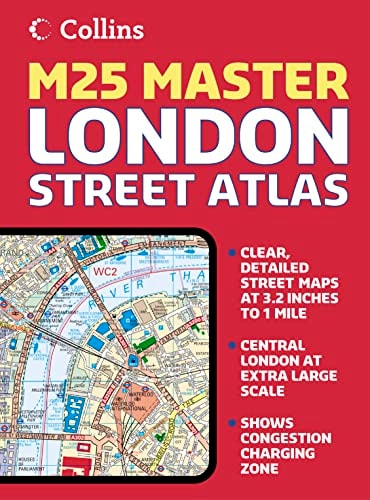
This attractive atlas covering the whole of the M25 area includes a huge amount of detail with a high level of clarity. Presented with "lie-flat" spiral binding, this detailed street atlas covers the whole of the M25 London orbital motorway area at 3.2 inches to 1 mile with an extended area of central London stretching from Kensington Gardens to Greenwich at the extra large scale of 6.3 inches to 1 mile. The atlas has a fine grid system making it extremely easy to use. It includes color-classified roads and buildings; postal district boundaries; car parks, hospitals, and police stations; and places of interest. The area of coverage extends from Brookmans Park in the north to Redhill in the south and from Slough in the west to Gravesend in the east.
Menrva's Summary
THE THESIS
This atlas serves as a comprehensive navigational reference for the M25 orbital motorway and the surrounding Greater London metropolitan area. The publication provides high-resolution cartographic data designed for practical use by motorists and urban navigators. By utilizing a standardized grid system and color-coded infrastructure, the work facilitates efficient route planning and location identification within a complex urban environment.
THE SCOPE MAP
What You Will Find
- Detailed street-level mapping of the entire M25 orbital motorway region.
- Specialized high-scale cartography for central London, ranging from Kensington Gardens to Greenwich.
- A functional grid system for rapid coordinate location.
- Comprehensive indexing of public infrastructure including hospitals, police stations, and car parks.
- Visual classification of road networks and postal district boundaries.
THE AUTHORITY PERSPECTIVE
The subject matter points to a highly functional, utilitarian tool intended for practical navigation rather than academic study. The framing suggests a dense, specialist resource designed for consistent use by those requiring precise spatial orientation within the London orbital corridor.
Page Count:
352
Publication Date:
2005-04-04
Publisher:
Collins
ISBN-10:
0007192010
ISBN-13:
9780007192014
Travel
Transportation
Reference
Atlases & Maps
Geography
Maps
London
Community Tags
Similar Books