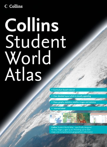
Collins Student Atlas
0
0
As an Amazon Associate and affiliate partner, Menrva Books earns from qualifying purchases. Learn more
Author Description
Completely new edition and rebranded edition of the best-selling Collins Longman Student Atlas. Perfectly created for Key Stage 4 students and a vital tool for all students. Collins Student Atlas is a completely new edition of the highly successful Collins Longman Student Atlas. It features 128 pages of up-to-date reference and thematic mapping, 8 pages of World country-by-country statistics and a fully comprehensive index to all names appearing on the reference maps. The Atlas has been specifically designed for students aged 14 to 16, however its well-researched uncluttered design makes it easy for all student use. This new edition features extended map coverage on each page and colour coding has been introduced in the titling and marginalia to create distinct, easy to use sections. Thematic maps and accompanying graphs and tables adhere strictly to the National curriculum and cover topics such as tourism, telecommunications, environmental and socio-economic topics. All maps have been fully up-dated using the latest statistical information available. The inclusion of a list of relevant web addresses on each thematic page ensures students are motivated to explore more deeply into a topic. High quality satellite imagery, which has been selectively used within the special topic or study areas, supports data on the maps and is used to illustrate key environmental issues. Extensive lists of statistics for demographic and socio-economic facts provide up-to-date data for students wishing to create their own graphics to support individual geographical, tourist, mathematical, economic or IT projects.
Menrva's Summary
THE THESIS
This atlas serves as a comprehensive geographical reference tool designed to support the academic requirements of students aged 14 to 16. The volume provides updated mapping and statistical data, aligning with national curriculum standards to facilitate research in subjects ranging from economics to environmental science. By integrating traditional cartography with modern satellite imagery and digital resources, the work offers a structured framework for geographical inquiry.
THE SCOPE MAP
What You Will Find
- 128 pages of up-to-date reference and thematic mapping.
- Integrated statistical data for demographic and socio-economic analysis.
- Satellite imagery used to illustrate environmental and geographical study areas.
- A curated list of web addresses to encourage independent research.
THE AUTHORITY PERSPECTIVE
The design of this atlas suggests a focus on clarity and accessibility, prioritizing an uncluttered layout suitable for secondary education environments. Its reliance on standardized curriculum topics and updated statistical datasets positions it as a practical resource for students engaged in project-based learning.
Page Count:
168
Publication Date:
1750-01-01
Publisher:
Harpercollins Pub Ltd
ISBN-10:
0007198418
ISBN-13:
9780007198412
Atlases
Education
Reference
Cartography
Geography
Community Tags
Similar Books