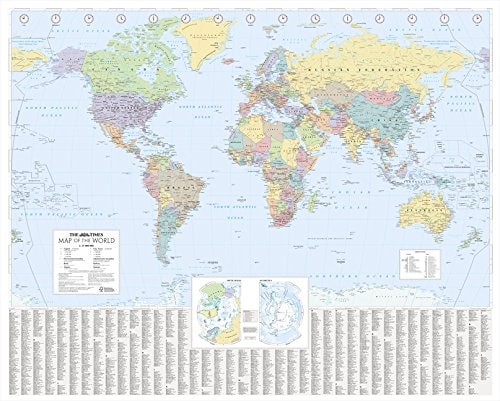
The Times World Wall Laminated Map
0
0
As an Amazon Associate and affiliate partner, Menrva Books earns from qualifying purchases. Learn more
Author Description
No description available.
Menrva's Summary
THE THESIS
This reference tool provides a comprehensive, high-resolution visual representation of the Earth's political and physical geography for educational and professional utility. The Times Atlases editorial team utilizes cartographic data to present a clear, durable, and laminated wall-mounted resource. The work serves as a primary reference for tracking international borders, major urban centers, and topographical features on a global scale.
THE SCOPE MAP
What You Will Find
- Detailed political boundaries and international country borders
- Major city locations and regional administrative centers
- Physical geography including mountain ranges and major water bodies
- Laminated, wipe-clean surface for long-term durability and annotation
THE AUTHORITY PERSPECTIVE
The subject matter points to a standard, high-utility reference tool designed for classrooms, offices, and home study environments. The framing suggests a focus on clarity and durability, prioritizing functional cartography over interpretive analysis.
Page Count:
144
Publication Date:
2010-03-01
Publisher:
HarperCollins UK
ISBN-10:
0007326890
ISBN-13:
9780007326891
Maps
Geography
Atlases
Reference
Community Tags
Similar Books