History of London through A-Z Maps
0
0
As an Amazon Associate and affiliate partner, Menrva Books earns from qualifying purchases. Learn more
Author Description
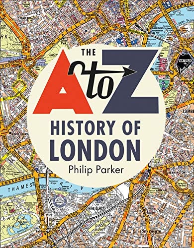
For the last century A-Z maps have been the trusted and reliable source of mapping for Londoners. As the face of London has changed so have the maps. This history will outline these changes and reveal how the city has changed over the last 100 years. Did you know that Wembley Stadium used to be a Greyhound racing circuit, that the Millennium Dome is the biggest structure of its kind in the world, and that the London Eye was not the first big wheel in London?
Menrva's Summary
THE THESIS
This book chronicles the evolution of London over the past century, as reflected in the changing cartography of A-Z maps. Philip Parker, a historian specializing in urban development, utilizes a century's worth of A-Z maps as his primary source to illustrate the physical and functional transformations of the city. The book argues that these maps serve as a unique lens through which to understand London's development, from the rise of iconic structures to the shifts in its infrastructure and entertainment venues.
THE SCOPE MAP
- A historical overview of London's development over the last 100 years.
- Analysis of how A-Z maps have documented these changes.
- Specific examples of London's transformations, such as Wembley Stadium's past use and the significance of the Millennium Dome.
- Insights into lesser-known historical facts, like the existence of earlier Ferris wheels in London before the London Eye.
THE AUTHORITY PERSPECTIVE
The book is presented as an accessible exploration of London's history through the tangible medium of its maps. The author's approach suggests a focus on visual evidence and factual recounting of urban change. The framing implies that the book will appeal to those interested in London's past, cartography, and the evolution of urban landscapes, offering a unique perspective on familiar landmarks and forgotten histories.
Page Count:
256
Publication Date:
2020-01-01
Publisher:
Collins UK
ISBN-10:
0008351767
ISBN-13:
9780008351762
History
Non-Fiction
London
Maps
Community Tags
Similar Books