Wales Geopack
0
0
As an Amazon Associate and affiliate partner, Menrva Books earns from qualifying purchases. Learn more
Author Description
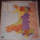
A double-sided map of Wales which displays political and physical information on a scale of 1:250,000, with place names in English where possible. The laminated map measures 110 x 95cm, and hanging strips are included. (ACCAC)
Menrva's Summary
THE THESIS
This map provides a comprehensive overview of Wales, detailing both its political and physical geography at a scale of 1:250,000. It aims to offer users a clear and accessible representation of the country's landscape and administrative divisions. The map is designed for practical use, incorporating place names in English where feasible.
THE SCOPE MAP
- Detailed political boundaries and administrative divisions of Wales.
- Comprehensive physical geography, including topography, rivers, and coastlines.
- Scale of 1:250,000 for accurate representation.
- Place names primarily in English for accessibility.
- Double-sided format for maximum information display.
- Laminated for durability.
- Includes hanging strips for easy display.
THE AUTHORITY PERSPECTIVE
This map is a practical tool for anyone seeking detailed geographical information about Wales. Its scale and dual presentation of political and physical data make it suitable for planning, education, or general reference. The inclusion of English place names enhances its usability for a wider audience.
Page Count:
0
Publication Date:
1900-01-01
Publisher:
Y Lolfa
ISBN-10:
000077636X
ISBN-13:
9780000776365
Travel
Non-Fiction
Geography
Maps
Community Tags
Similar Books