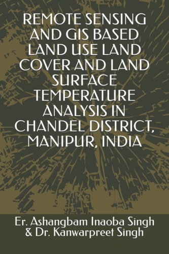
Remote Sensing and GIS Based Land Use Land Cover and Land Surface Temperature Analysis in Chandel District, Manipur, India
0
0
As an Amazon Associate and affiliate partner, Menrva Books earns from qualifying purchases. Learn more
Author Description
NONE. Menrva holds no usable description for this book. Unless you genuinely and specifically know this published work, set sufficient_material=false. Do NOT infer a plot, characters, or contents from the title.
Menrva's Summary
THE THESIS
This study investigates the spatial and temporal variations of land use, land cover, and land surface temperature in Chandel District, Manipur, India, utilizing remote sensing and GIS techniques. The research aims to provide a comprehensive analysis of environmental changes by examining satellite imagery and geographic information systems data. It focuses on understanding the relationship between land surface characteristics and temperature fluctuations, offering insights into the region's environmental dynamics and potential impacts.
THE SCOPE MAP
- Analysis of Land Use Land Cover (LULC) changes over time.
- Mapping of Land Surface Temperature (LST) distribution.
- Correlation between LULC patterns and LST variations.
- Application of remote sensing data (e.g., satellite imagery).
- Utilisation of Geographic Information Systems (GIS) for spatial analysis.
- Case study focused on Chandel District, Manipur, India.
- Assessment of environmental changes and their drivers.
THE AUTHORITY PERSPECTIVE
This work presents a focused environmental analysis using established scientific methodologies. The application of remote sensing and GIS for LULC and LST studies is a common approach in environmental science, suggesting a rigorous, data-driven methodology. The specific regional focus on Chandel District, Manipur, indicates a contribution to understanding local environmental conditions within India.
Page Count:
53
Publication Date:
2022-02-05
Publisher:
Independently published
ISBN-13:
9798417099700
Science
Non-Fiction
India
Remote sensing
Land Use
Community Tags
Similar Books