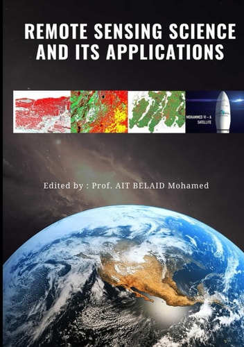
Remote Sensing Science and Its Applications
0
0
As an Amazon Associate and affiliate partner, Menrva Books earns from qualifying purchases. Learn more
Author Description
Professor Mohamed Ait Belaid, Philosophiae Doctor (Ph.D.) in Geodetic Sciences & Remote Sensing and Master of Science (M.Sc.) in Geodesy both from Laval University in Canada (1990 & 1986), as well as Engineer (B.Sc.) in Surveying from Agronomic Institute Hassan-II in Morocco (1979). Over 38 years of expertise in the fields of Geomatic Sciences from which 13 years within the agriculture department (ORMVAD) as leader of one the biggest irrigation project in Morocco, 10 years at the Royal Center for Remote Sensing (CRTS), head of department of natural resources & environment, and finally 15 years at the Arabian Gulf University (AGU) in Bahrain (His Highness Shaikh Hamad Bin Khalifa Al-Thani’s academic chairman of GIS, as well as the development of a new educational program on GIS/RS). Elected to the Position of Vice-Chairman & Rapporteur of the Committee of UN on the Exploration & Peaceful Uses of Outer Space (COPUOS) in Vienna (1997-2000), as well as Vice-President and Rapporteur General for UNConference on the Exploration and Peaceful Uses of Outer Space (UNISPACE-III) in Austria (1999). Awarded Zayed International Prize for the Environment as one of the authors of the Millennium Ecosystem Assessment Program of the UN by United Arab Emirates(2006). THE BOOK: Remote Sensing Science and Its Applications book is linked to the earth surface illustrated by the tree components which are the soil, vegetation and water. The earth is sensed by different satellites systems and the historical data are available for over 50 to 60 years. The book is subdivided into ten chapters: Basic Concept and Principles of Remote Sensing of the Earth Surface. Theories and Processing of Microwave Images – RADAR Including a List of Microwave Satellite and Applications. The Thermal Survey and Multispectral Scanning (MSS) of Satellite Images. Spacecraft and Sensors as a Source of Data Including Earth Observation Satellites (LANDSAT, SPOT, IRS, IKONOS, QuickBird, WorldView
Menrva's Summary
THE THESIS
This book investigates the fundamental principles of remote sensing and its diverse applications in understanding the Earth's surface. Professor Mohamed Ait Belaid, with over 38 years of expertise in Geomatic Sciences, draws upon his extensive experience to present a comprehensive overview of remote sensing technologies. The book focuses on the interconnectedness of soil, vegetation, and water, utilizing data from satellite systems that have collected historical information for the past 50 to 60 years. It aims to provide a thorough understanding of how these technologies contribute to environmental monitoring and resource management.
THE SCOPE MAP
- Foundational concepts and principles of remote sensing for Earth surface analysis.
- Theories and processing techniques for microwave images, including RADAR, satellite lists, and applications.
- Detailed exploration of thermal surveys and Multispectral Scanning (MSS) from satellite imagery.
- Information on spacecraft and sensors as data sources, with specific examples like LANDSAT, SPOT, IRS, IKONOS, QuickBird, and WorldView.
THE AUTHORITY PERSPECTIVE
Based on the author's extensive academic and professional background, this book is positioned as a detailed technical resource for professionals and students in geomatics and earth sciences. The inclusion of specific satellite systems and processing techniques suggests a focus on practical application and data analysis. The author's credentials, including significant roles in international space committees and environmental assessments, indicate a high level of authority and expertise in the subject matter.
Page Count:
240
Publication Date:
2022-08-06
Publisher:
Independently published
ISBN-13:
9798843188382
Science
Non-Fiction
Remote sensing
Geomatics
Earth Science
Community Tags
Similar Books