
Concise Historical Atlas of the U.S. Civil War
0
0
As an Amazon Associate and affiliate partner, Menrva Books earns from qualifying purchases. Learn more
Author Description
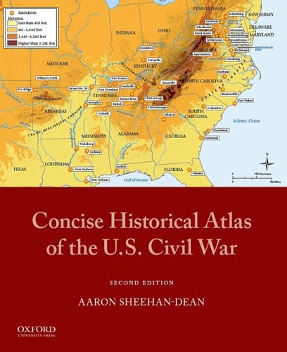
There are few events as central to the American historical consciousness as the Civil War, which is a fascinating area of interest for students and general readers alike. One of the most efficient ways to study a war is with an atlas; however, most of the atlases devoted to this period focus almost exclusively on military movements and are prohibitively expensive for use in undergraduate courses. Offering a striking and reasonably priced alternative to these books, the Concise Historical Atlas of the U.S. Civil War is the only atlas that includes data maps and covers key issues before and after the war years. It balances military and non-military coverage, presenting maps that deal with political and social changes as well as campaign and battle maps.Laid out chronologically and representing the complexity of the war both visually and textually, Concise Historical Atlas of the U.S. Civil War is an ideal study aid. Through detailed presentation of physical geography, it highlights the role of the landscape in troop movements and in social and demographic developments. Students can follow all the major campaigns of both the eastern and western theaters, examine the tactical movements in the major battles, and explore the geographic patterns behind issues like emancipation, occupation, and internal conflicts. The atlas features maps dealing with such subjects as economic capacity (both agricultural and industrial), enlistment rates, and the movement of escaped slaves. The maps also integrate information on the divisions that existed within the North and the South themselves. Accessible to students with limited geographic knowledge, the maps are clearly labeled, with key features marked. Each map is accompanied by a short narrative that provides helpful contextual information.Featuring uniquely comprehensive coverage, the Concise Historical Atlas of the U.S. Civil War includes several maps situating the conflict in its antebellum origins as well as maps--of politics, sh
Menrva's Summary
THE THESIS
How can a cartographic resource effectively synthesize the military, social, and political complexities of the American Civil War for a general and undergraduate audience? Aaron Sheehan-Dean, a historian specializing in the American Civil War, addresses the limitations of traditional military-focused atlases by providing a broader analytical framework. By integrating demographic, economic, and political data alongside tactical battle maps, the author argues that the war's outcome and impact are best understood through the lens of physical and social geography.
THE SCOPE MAP
What You Will Find
- Chronological mapping of major military campaigns in both the eastern and western theaters.
- Data-driven visualizations of economic capacity, including agricultural and industrial output.
- Geographic analysis of social phenomena such as emancipation, enlistment rates, and the movement of enslaved people.
- Contextual narratives accompanying each map to explain the political and demographic shifts of the antebellum and post-war periods.
THE AUTHORITY PERSPECTIVE
Experts and educators frequently cite this work as a foundational resource for undergraduate history courses due to its balance of accessibility and academic rigor. Readers note that the inclusion of non-military data sets provides a more holistic understanding of the conflict than traditional tactical atlases.
Page Count:
128
Publication Date:
2008-12-02
Publisher:
Oxford University Press
ISBN-10:
0195309561
ISBN-13:
9780195309560
History
Civil War
Military History
Atlases
United States
Reference
Community Tags
Other Editions(2)
Similar Books



Reader Comments
Share Your Thoughts
No comments yet. Be the first to share your thoughts!