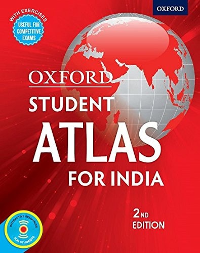
Oxford Student Atlas for India
0
0
As an Amazon Associate and affiliate partner, Menrva Books earns from qualifying purchases. Learn more
Author Description
The Oxford Student Atlas for India uses the latest state-of-the-art techniques to produce maps that are accurate and easy to read. It meets the syllabi requirements of various education boards in India. Thoroughly researched and up-to-date, this second edition of the atlas also caters to the needs of the students preparing for competitive examinations conducted by the UPSC, State Public Service Commissions and other examining bodies. Key Features • Provides the latest available socio-economic maps and data culled from authoritative sources • Provides special sections on the history of map-making and concepts of contour and landforms in the beginning of the atlas • Covers important topical themes such as biosphere reserves, wetlands and wildlife, power projects, agricultural regions, levels of industrial development, human development, tourism and mass media, cultural realms, heritage, etc. • Includes 24 maps focusing on the history of Indian subcontinent and 8 maps focusing on environmental concerns and natural disasters of the country • Includes an informative section on world history, a world time zone map and world – geographic comparisons • Student-friendly and easy–to-use with both pictorial and graphical representation • Contains a fully updated and revised index Exam-oriented Features • Includes an enhanced section of practice questions based on the question pattern of competitive exams • Provides specific references to maps with relevant data to solve the practice questions • Acts as an easy-to-use practice guide for map and atlas-based questions Supplements In the CD: • New animations explaining important geographical concepts • Informative presentations on several themes about India • Interesting description of Indian and world history • Select regional maps of countries and regions of the world (including SAARC nations) • Revised interactive games and quizzes • Exciting puzzles and printable outline maps Pull-Outs: • Poster size wall map of India – Politi
Menrva's Summary
THE THESIS
This atlas serves as a comprehensive cartographic and data-driven reference tool designed to support academic curricula and competitive examination preparation within the Indian educational landscape. The Oxford University Press editorial team utilizes current socio-economic data and advanced mapping techniques to provide a precise visual representation of India's physical, political, and historical geography. By integrating thematic maps with practice-oriented exercises, the text functions as both a study aid and a foundational resource for students navigating standardized testing requirements.
THE SCOPE MAP
What You Will Find
- Detailed socio-economic, political, and physical maps of India and the world.
- Specialized sections on historical map-making, contour analysis, and landform classification.
- Topical coverage including biosphere reserves, power projects, industrial development, and human development indices.
- Exam-focused practice questions and data-referenced exercises aligned with UPSC and State Public Service Commission standards.
THE AUTHORITY PERSPECTIVE
Educators and students frequently identify this volume as a standard reference for geography-based competitive exams in India due to its alignment with official syllabi. Experts highlight the balance between technical cartographic accuracy and the inclusion of practical, exam-oriented study materials.
Page Count:
160
Publication Date:
2017-01-01
Publisher:
Oxford
ISBN-10:
0199485127
ISBN-13:
9780199485123
India
Geography
Subjects
Study Guides
Education
Atlases
Reference
Community Tags
Other Editions(3)

Similar Books






Reader Comments
Share Your Thoughts
No comments yet. Be the first to share your thoughts!