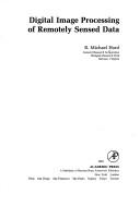
Digital Image Processing of Remotely Sensed Data
0
0
As an Amazon Associate and affiliate partner, Menrva Books earns from qualifying purchases. Learn more
Author Description
Author description coming soon. We're reaching out to them in the ether...
Menrva's Summary
THE THESIS
This book investigates the application of digital image processing techniques to remotely sensed data. It aims to provide a comprehensive overview of the methods and algorithms used to analyze and interpret imagery acquired from satellites and aircraft, covering fundamental concepts, preprocessing steps, and advanced analysis techniques. The text is structured to guide readers through the complexities of digital image manipulation for extracting meaningful information from Earth observation data.
THE SCOPE MAP
- Fundamentals of digital image processing relevant to remote sensing
- Image acquisition and preprocessing techniques
- Image enhancement and restoration methods
- Image transformation and feature extraction
- Image classification and analysis
- Applications in various fields of remote sensing
THE AUTHORITY PERSPECTIVE
The book is recognized as a foundational text in the field of digital image processing for remote sensing. Its detailed approach to fundamental concepts and practical applications makes it a valuable resource for students and professionals. The comprehensive coverage of preprocessing, enhancement, and classification techniques provides a solid understanding of the methodologies. The text is likely to be appreciated for its systematic exposition of complex topics within geospatial data analysis.
Page Count:
256
Publication Date:
1982-01-01
ISBN-10:
0123556201
ISBN-13:
9780123556202
Non-Fiction
Science
Image Processing
Computer Science
Remote sensing
Community Tags
Similar Books