Collins London Street Atlas
0
0
As an Amazon Associate and affiliate partner, Menrva Books earns from qualifying purchases. Learn more
Author Description
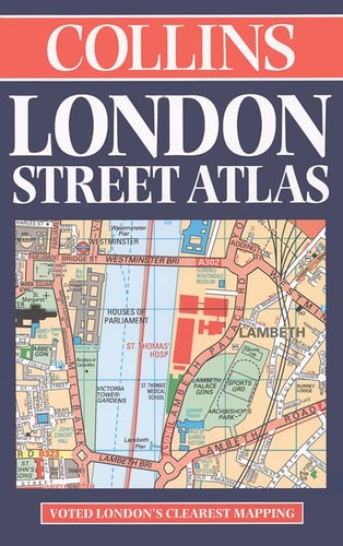
This vinyl-covered street atlas of inner and outer London includes places of interest, theatre, cinema and shopping maps and full indexes to streets and place names. Central London is covered at a scale of 7.68 inches to 1 mile and Outer London is covered at 3.84 inches to 1 mile.
Menrva's Summary
THE THESIS
This atlas provides a comprehensive cartographic resource designed to facilitate navigation and orientation within the complex urban landscape of London. The work serves as a practical tool for residents and visitors, utilizing precise scale measurements to translate the city's sprawling street network into a manageable, portable format. By integrating detailed street indexes with specialized maps for commerce and entertainment, the author offers a structured spatial framework for navigating both central and suburban districts.
THE SCOPE MAP
What You Will Find
- Detailed street-level cartography for both inner and outer London districts.
- Dual-scale mapping system featuring 7.68 inches to 1 mile for central areas and 3.84 inches to 1 mile for outer regions.
- Comprehensive alphabetical indexes for streets and place names.
- Specialized inset maps highlighting theaters, cinemas, and shopping centers.
THE AUTHORITY PERSPECTIVE
The technical specifications and focus on urban navigation suggest a highly functional, utilitarian resource intended for practical, daily use. The inclusion of specialized interest maps indicates a design tailored to support both logistical transit and recreational planning within the metropolitan area.
Page Count:
368
Publication Date:
1998-01-01
Publisher:
HarperCollins Publishers
ISBN-10:
0004487877
ISBN-13:
9780004487878
Travel
Reference
London Greater London
Maps
London
Geography