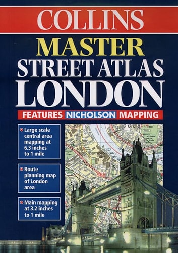
Master Street Atlas of London
0
0
As an Amazon Associate and affiliate partner, Menrva Books earns from qualifying purchases. Learn more
Author Description
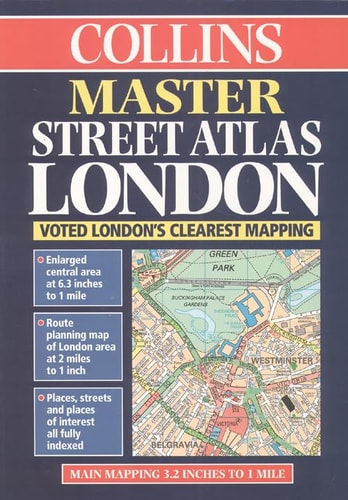
1:20,000 3.2 inches to 1 mile, 1:10,000 6.3 inches to 1 mile Durable hard back atlas using the Bartholomew digital database mapping. A huge amount of detail is included with a high level of clarity
Menrva's Summary
THE THESIS
This atlas serves as a comprehensive navigational reference tool designed to provide precise spatial orientation across the Greater London area. Utilizing the Bartholomew digital database, the work offers high-resolution mapping at multiple scales to assist users in identifying street-level detail and urban infrastructure. The publication prioritizes clarity and durability to function as a reliable resource for both professional and personal navigation.
THE SCOPE MAP
What You Will Find
- Detailed street-level mapping at 1:20,000 and 1:10,000 scales.
- Standardized cartographic representations of London's road networks.
- High-contrast visual data derived from the Bartholomew digital database.
- Durable hardcover binding intended for frequent reference use.
THE AUTHORITY PERSPECTIVE
The technical specifications and reliance on established cartographic databases suggest a focus on functional accuracy and ease of use for the reader. This atlas is positioned as a practical utility for those requiring a static, high-detail reference for navigating the complexities of the London metropolitan area.
Page Count:
304
Publication Date:
1999-01-01
Publisher:
HarperCollins Publishers
ISBN-10:
0004488385
ISBN-13:
9780004488387
London
Maps
Reference
Geography
Atlases & Maps
London Greater London
Cartography