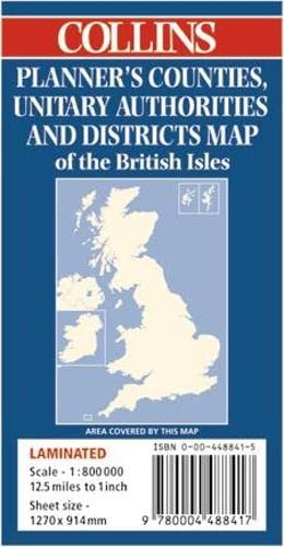
Counties, Unitary Authorities and Districts Map of the British Isles
0
0
As an Amazon Associate and affiliate partner, Menrva Books earns from qualifying purchases. Learn more
Author Description
The counties and regions of the British Isles are named on this revised map that comes in a tube, while the districts are numbered and can be identified by reference to the comprehensive list at the side of the map. A large scale inset map of London, and motorways and main roads are also featured.
Menrva's Summary
THE THESIS
This map serves as a comprehensive visual reference tool designed to clarify the complex administrative boundaries of the British Isles. The author, Mike Cottingham, utilizes cartographic precision to organize counties, unitary authorities, and districts into a single, accessible format. By pairing a large-scale visual representation with a structured index, the work provides a clear framework for identifying regional divisions and major transportation infrastructure.
THE SCOPE MAP
What You Will Find
- Detailed administrative boundaries for counties, unitary authorities, and districts across the British Isles.
- A comprehensive reference index for district identification.
- A large-scale inset map specifically detailing the London metropolitan area.
- Integrated mapping of the primary motorway and main road network.
THE AUTHORITY PERSPECTIVE
The work functions as a standard cartographic reference, providing a clear and functional layout for those requiring administrative clarity. Its utility is defined by the inclusion of both regional overviews and specific urban insets, making it a practical resource for geographical study.
Page Count:
0
Publication Date:
1998-06-01
Publisher:
HarperCollins Publishers Limited
ISBN-10:
0004488415
ISBN-13:
9780004488417
Politics
Atlases & Maps
United Kingdom
Politics & Government
Geography
Cartography
Reference
World politics
Maps
Community Tags
Similar Books