Central Glasgow Street Atlas
0
0
As an Amazon Associate and affiliate partner, Menrva Books earns from qualifying purchases. Learn more
Author Description
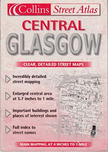
This handy atlas (21x15 cm (8 1/4 x 6 in), 62 pages) covers the city of Glasgow from Hillington to Garthamlock and from Maryhill to Pollokshaws including the corresponding sections of M8, M80 and M77 motorways at scale 1:15,900; enlarged street map of Glasgow´s city centre at 1:11,000 and comprehensive street name index are included.
Menrva's Summary
THE THESIS
This atlas provides a comprehensive cartographic reference for navigating the urban and suburban landscape of Glasgow. The work serves as a practical tool for commuters, residents, and visitors, offering detailed street-level mapping and motorway connectivity. It utilizes a standardized scale to ensure clarity for users traversing the city from Hillington to Garthamlock.
THE SCOPE MAP
What You Will Find
- Detailed street maps covering the Glasgow metropolitan area at a 1:15,900 scale.
- An enlarged, high-detail map of the Glasgow city centre at a 1:11,000 scale.
- Coverage of major transit arteries including the M8, M80, and M77 motorways.
- A comprehensive alphabetical index of street names for efficient location lookup.
THE AUTHORITY PERSPECTIVE
The subject matter points to a functional, specialist reference tool designed for physical navigation within an urban environment. The framing suggests a focus on clarity and utility for individuals requiring precise geographical data for the Glasgow region.
Page Count:
62
Publication Date:
2001-01-01
Publisher:
Collins
ISBN-10:
0007113161
ISBN-13:
9780007113163
Travel
Maps
Atlases
Geography
Reference
Scotland
Glasgow
Roads -
Community Tags
Similar Books