2002 Handy Town Plan Atlas Britain
0
0
As an Amazon Associate and affiliate partner, Menrva Books earns from qualifying purchases. Learn more
Author Description
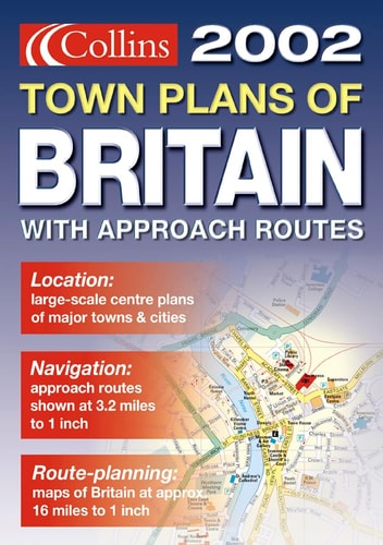
Planning Maps at 1:1m 16 miles to 1 inch. Approach routes at 1:200,000 3.2 miles to 1 inch. N. Scotland at 1:317,000 5 miles to 1 inch. Town plans at various scales. The handy A5 format of this atlas makes it the ideal travelling companion fitting neatly into the glovebox, pocket or bag.
Menrva's Summary
THE THESIS
This atlas serves as a portable, multi-scale navigational reference designed to assist travelers in navigating the road networks and urban centers of Great Britain. The publication provides a structured collection of cartographic data, ranging from broad-scale planning maps to localized town plans, intended for quick reference during transit. By organizing geographic information into a compact A5 format, the work prioritizes accessibility and ease of use for drivers and pedestrians alike.
THE SCOPE MAP
What You Will Find
- Planning maps at a scale of 1:1,000,000 for regional overview.
- Detailed approach routes at a scale of 1:200,000.
- Specialized cartography for Northern Scotland at 1:317,000.
- A collection of urban town plans at varying scales for city navigation.
THE AUTHORITY PERSPECTIVE
The subject matter points to a functional, utilitarian reference tool intended for practical navigation rather than academic study. Its design suggests a focus on physical portability and rapid information retrieval for the mobile user.
Page Count:
126
Publication Date:
2004-05-01
Publisher:
Harper Collins
ISBN-10:
0007118066
ISBN-13:
9780007118069
Travel
Maps
Geography
Atlases
Reference
Great Britain
Community Tags
Similar Books