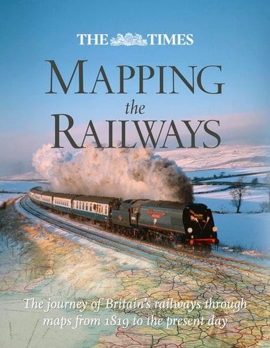
The Times Mapping the Railways: The Journey of Britain's Railways Through Maps from 1819 to the Present Day
0
0
As an Amazon Associate and affiliate partner, Menrva Books earns from qualifying purchases. Learn more
Author Description
Railways appear in almost every type of map available throughout the nineteenth and twentieth centuries. Detailed Parliamentary plans were drawn up for hundreds of proposed railway schemes (many of which never got past the drawing board). Once built, the Ordnance Survey then plotted the lines onto their national maps of Britain. Cartographers such as John Barthomolew & Son, Cruchley and Bradshaw, were commissioned to draw vast numbers of railway maps during the boom years. Maps were produced as an aid to the management of the railways; to promote the railway companies’ networks; and to enable passengers to plan their journeys, then understand the passing scene as they gazed from the carriage window. Thirty mileposts describe the history of the railways; Alongside the maps are a series of "milepost" features which give a detailed description of key events and eras in the history of Britain’s railways. The nineteenth century saw the foundations laid for our modern railway network, with huge building projects constructing thousands of miles of track, bridges, and tunnels. This expansion slowed in the early twentieth century as competition from the car and the lorry began to bite. The railways made an enormous contribution to the World Wars, then underwent massive re-equipment after nationalisation, before changing drastically following the famous "Beeching Report" of 1963. The modern era has seen an expansion of the network again, with the Channel Tunnel built, and branch lines closed in the 1960s re-opening for business in the later years of public ownership and the first two decades of the privatised railway.
Menrva's Summary
THE THESIS
This work investigates the evolution of Britain's railway network by analyzing the intersection of cartographic history and industrial development from 1819 to the present. Authors Julian and Spaven Holland utilize a vast collection of historical maps—ranging from Parliamentary planning documents to commercial passenger guides—to illustrate how the physical expansion and contraction of the rail system mirrored the broader socio-economic shifts in British society. The text provides a chronological framework that links specific cartographic artifacts to the technological and political milestones of the railway era.
THE SCOPE MAP
What You Will Find
- A comprehensive collection of historical maps including Parliamentary plans, Ordnance Survey charts, and commercial railway guides.
- Thirty distinct "milepost" features detailing key historical events such as the Beeching Report and the impact of the World Wars.
- Analysis of the transition from the nineteenth-century construction boom to the modern era of privatization and network expansion.
- Examination of the role of cartography in railway management, corporate promotion, and passenger navigation.
THE AUTHORITY PERSPECTIVE
The text serves as a dense, visually-oriented reference for historians and railway enthusiasts interested in the intersection of infrastructure and mapping. Its reliance on primary cartographic sources provides a clear, methodical overview of how Britain's rail landscape has been documented and transformed over two centuries.
Page Count:
304
Publication Date:
2011-11-01
Publisher:
Collins Geo
ISBN-10:
0007435991
ISBN-13:
9780007435999
History
Transportation
Reference
Railways
Cartography
Railroads
British History
Railroads_maps
Community Tags
Similar Books