The Times Britain from Space
0
0
As an Amazon Associate and affiliate partner, Menrva Books earns from qualifying purchases. Learn more
Author Description
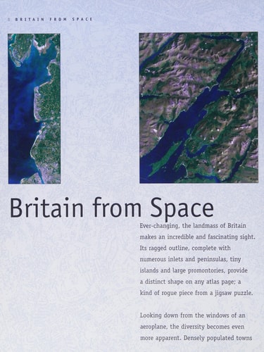
This satellite atlas covers the whole of Britain from Land's End to Orkney, Ireland to East Anglia. Each photograph is accompanied by a map and text to highlight the main features of particular areas.
Menrva's Summary
THE THESIS
This atlas investigates the geography and topography of the British Isles by synthesizing high-resolution satellite imagery with traditional cartographic data. The Times Mind Games staff utilizes a comprehensive collection of aerial photography to provide a visual survey of the United Kingdom and Ireland. By pairing these images with detailed maps and descriptive text, the work offers a structured framework for understanding the physical landscape and human development across the region.
THE SCOPE MAP
What You Will Find
- High-resolution satellite photography covering the entirety of Britain and Ireland.
- Detailed cartographic overlays for geographical orientation.
- Descriptive analysis of major landmarks and regional features.
- A systematic survey ranging from Land's End to the Orkney Islands.
THE AUTHORITY PERSPECTIVE
The work serves as a practical reference tool for those interested in the intersection of satellite technology and regional geography. Its structured approach provides a clear, accessible overview of the British landscape for both casual observers and geography enthusiasts.
Page Count:
128
Publication Date:
2001-09-03
Publisher:
Harpercollins Pub Ltd
ISBN-10:
0007105843
ISBN-13:
9780007105847
Photography
Atlases
United Kingdom
Geography
Reference
Community Tags
Similar Books