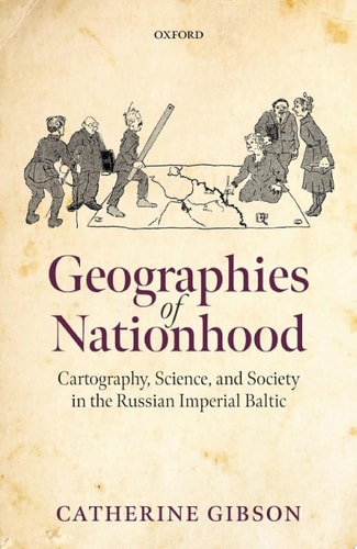
Geographies of Nationhood: Cartography, Science, and Society in the Russian Imperial Baltic
0
0
As an Amazon Associate and affiliate partner, Menrva Books earns from qualifying purchases. Learn more
Author Description
Geographies of Nationhood examines the meteoric rise of ethnographic mapmaking in the nineteenth and early twentieth centuries as a form of visual and material culture that gave expression to territorialised visions of nationhood. In the Russian Empire's Baltic provinces, the development of ethnographic cartography, as part of the broader field of statistical data visualisation, progressively became a tool that lent legitimacy and an experiential dimension to nationalist arguments, as well as a wide range of alternative spatial configurations that rendered the inhabitants of the Baltic as part of local, imperial, and global geographies. Catherine Gibson argues that map production and the spread of cartographic literacy as a mass phenomenon in Baltic society transformed how people made sense of linguistic, ethnic, and religious similarities and differences by imbuing them with an alleged scientific objectivity that was later used to determine the political structuring of the Baltic region and beyond. Geographies of Nationhood treads new ground by expanding the focus beyond elites to include a diverse range of mapmakers, such as local bureaucrats, commercial enterprises, clergymen, family members, teachers, and landowners. It shifts the focus from imperial learned and military institutions to examine the proliferation of mapmaking across diverse sites in the Empire, including the provincial administration, local learned societies, private homes, and schools. Understanding ethnographic maps in the social context of their production, circulation, consumption, and reception is crucial for assessing their impact as powerful shapers of popular geographical conceptions of nationhood, state-building, and border-drawing.
Menrva's Summary
THE THESIS
This work investigates how the emergence of ethnographic mapmaking in the Russian Imperial Baltic provinces functioned as a mechanism for constructing and legitimizing territorialized visions of nationhood. Catherine Gibson, a historian specializing in the cultural history of the Russian Empire, utilizes a wide array of archival materials, including statistical data visualizations and local administrative records, to argue that cartography transformed from an elite scientific pursuit into a mass-market tool for defining ethnic and linguistic boundaries. By examining the social context of map production, the author demonstrates how these visual artifacts provided a veneer of scientific objectivity that fundamentally altered political discourse and state-building efforts in the region.
THE SCOPE MAP
What You Will Find
- Analysis of ethnographic map production in the Baltic provinces during the nineteenth and early twentieth centuries.
- Examination of the role of non-elite actors, including clergymen, teachers, and private landowners, in the dissemination of cartographic literacy.
- Investigation into the intersection of statistical data visualization and nationalist political arguments.
Scope Limits
- The study focuses primarily on the Russian Imperial Baltic provinces rather than the entirety of the Russian Empire.
- The analysis prioritizes the social and cultural history of mapmaking over purely technical or military cartographic developments.
THE AUTHORITY PERSPECTIVE
Scholars in the field of European history and historical geography identify this text as a significant contribution to the study of visual culture and nationalism. Readers frequently note the meticulous archival research and the clarity with which the author connects local social practices to broader imperial political structures.
Page Count:
285
Publication Date:
2022-01-01
Publisher:
OUP Oxford
ISBN-10:
0192658298
ISBN-13:
9780192658296
History
Eastern Europe
Nationalism
Geography
European History
Cartography
Russian History
Sociology
Community Tags
Similar Books